
HazardHub
AI-driven peril risk scores, real-time geospatial data,
and underwriting recommendations for property insurance.
Achieve better business outcomes such as:
- 2 point loss ratio improvement
- 1.4 point expense ratio reduction
- 7% premium growth increase
Assess Faster, Price Smarter
Property underwriting is harder today than ever before. To win, insurers need comprehensive, predictive risk data embedded into their existing workflows.
Get 30x ROI with HazardHub
Lower loss costs and operational expenses with the most current and granular property risk data.
2 pt
Loss ratio improvement
Use predictive scores to filter out bad risks and decrease the likelihood of future claims.
1.4 pt
Expense ratio reduction
Automate quoting and focus inspections where they add the most value.
7%
Premium growth increase
Write more profitable business by pricing it right from the start.
See Every Peril Risk in Under Two Seconds
Watch how built-in intelligence gives property underwriters the data they need, right where they need it, to make quicker, more accurate calls.
50+ Peril Risk Scores, 1 API Call
Wildfire. Wind. Hail. Flood. Crime. If it can affect a property, it’s here. See the data for yourself below.
Understand a property’s wildfire risk before you make the call. Our Wildfire 3.0 model brings together proprietary data and advanced machine learning techniques, so you can see wildfire exposure in more detail that moves beyond standard US Forest Service data.
Key fire risk data includes:
- Fire Suppression Score: Local response speed and capability rating
- What Causes Wildfires?: Understanding ignition, spread, and prevention
- Essential Home Fire Safety Guide: Causes, Prevention, and Survival
- Fire Hydrant Distance: Nearest hydrant's type and distance grade
- Fire Station Response Time: Routing-based drive time to responding facility
- Fire Station Staffing: Personnel classification (Career vs. Volunteer)
- Wildfire Score: Proprietary wildfire risk grade
- WUI Indicator: Indication of property’s distance from wildland-urban interface
- AAIS Protection Class: Industry-standard 1-10 community safety rating
- Wildfire Fuel Type: Vegetation analysis surrounding the property
- Slope & Aspect: Topographical factors accelerating fire spread
- Hydrant Redundancy: Count of all hydrants within 1,000 feet
- Burn History: Proximity to historical wildfire perimeters and ignitions
Understand the weather risks tied to any address, including how often severe events happen and how exposed the property is today.
Key weather risk data includes:
- Hail Score: Modeled probability of damaging hail events
- Wind Score: Damaging wind risk with nearest wind incidents
- Tornado Score: Frequency and severity-based grade for tornadic activity
- Hurricane Score: Likelihood and intensity of tropical cyclone impacts
- Max Wind Speed: Maximum wind speed from historical observations data
- Lightning Strike Density: Ground lightning strikes within 10 miles last year
- Wind-Borne Debris: Risk level for projectile damage during high-wind events
- Tropical Storm Frequency: Historical recurrence of tropical systems
- Straight-Line Wind Risk: Vulnerability to non-tornadic wind damage
- Nearest Hail Incident: Size and date of the closest recorded hail fall
Flood zones only tell part of the story. We help you go beyond FEMA maps with a 360-degree view of water risk at the address level, including flooding, storm surge, and interior water damage.
Key water risk data includes:
- Flood Score: Proprietary grades for address-level flood risk
- Distance to Coast: Proximity to oceanic boundaries for saltwater exposure (beach, coast, and inland waterways)
- FEMA Flood Zone: Presence within 100-year or 500-year hazard areas
- Frozen Pipe Score: Propensity for interior pipe bursts in cold weather
- Mold Score: Environmental susceptibility for moisture and fungal growth
- Ice Dam Score: Likelihood of roof damage from freeze-thaw cycles
- SurgeMAX Score: Vulnerability to storm surge during tropical events
- Snow Load Score: Maximum weight-bearing requirements for roof integrity
- Sea Level Rise: Projected inundation depth for the property
- Coastal Barrier (CBRS): Status for federal flood insurance (NFIP) eligibility
See what’s happening beneath the surface before you bind. With address-level insight into seismic, geological, and terrain exposure, you can spot risks more clearly and avoid surprises in your underwriting.
Key earth risk data includes:- Sinkhole Susceptibility: Likelihood of ground collapse or subsidence
- Sinkhole Proximity: Distance to nearest recorded sinkhole incident
- Site Elevation: Absolute height above sea level for terrain analysis
- Slope & Aspect: Grade and orientation affecting ground stability and fire/flood risk
- Earthquake Score: Address-level seismic risk grade and MMI
- Distance to Fault Line: Precise proximity to known seismic features
- Radon Gas Exposure: Predicted indoor radon levels based on regional geology
- Landslide Score: Susceptibility to earth movement and slope failure
- Soil Shear Velocity: Analysis of foundation stability
Risk isn't always natural. HazardHub tracks thousands of man-made hazards that impact property value, safety, and liability.
Key man-made risk data includes:
- Crime Score: Address-specific ML-driven crime risk grade
- Property Crime Score: Risk level for burglary, larceny, and motor vehicle theft
- Violent Crime Score: Risk level for assault, robbery, and homicide
- Superfund Site Proximity: Distance to EPA-designated cleanup sites
- Brownfield Proximity: Distance to potentially contaminated land
- Underground Storage Tanks: Proximity to and density of active fuel tanks
- Leaking Underground Tanks: Proximity to leaking storage tanks
- Nuclear Facility Proximity: Distance to power plants and number of reactors
- Clandestine Drug Labs: Historical record of drug manufacturing on-site
- Liquor Licenses: Nearby liquor licenses and concentration of them in a radius
- Traffic Arteries: Proximity to high-volume highways and noise
Application estimates aren’t always the full picture. With county assessor data, structural details are verified rather than estimated, giving you a clearer view of property from the start.
Key property characteristic data includes:
- Year Built: Original year of construction
- Square Footage: Total finished living area
- Construction Type: Primary materials (Wood, Steel, Masonry)
- Building Condition: Physical state and maintenance level
- Roof Geometry: Design shape of the roof (Gable, Hip, etc.)
- Roof Material: Covering type (Shingle, Metal, Tile)
- Foundation Type: Sub-structure type (Slab, Basement, etc.)
- Number of Stories: Total vertical floors
- HVAC System: Primary heating and cooling technology
- Garage Capacity: Car space count and garage type
Ensure every property is Insured to Value (ITV) from day one. Our valuation module lets you use local data to estimate rebuild costs, so you can feel confident you’re not underinsuring.
Key replacement cost data includes:
- Final RCV: Total estimated cost to rebuild the structure
- Cost per Square Foot: Localized rebuilding rate for the area
- Debris Removal: Estimated cost to clear site after a loss
- Architect & Permit Fees: Professional and local government costs
- Materials & Labor: Detailed parts and labor cost split
- Contractor Overhead: Typical administrative costs for the region
- Contractor Profit: Estimated profit margin for reconstruction
- Construction Quality: Tier of finishes (Economy to Luxury)
- Physical Shape: Geometric complexity of the building footprint
- Commercial Cost Ranges: Low, medium, and high-tier estimates
Permits give you a reliable, third-party way to confirm property details. With access to our permit library, you can check roof age, flag unapproved additions, and see what major upgrades have been made over time.
Key permit data includes:
- Work Description: Technical scope provided to permitting agencies
- Number of Permits: Total volume of recorded filings for the property
- Permit Description: Detailed raw text of performed work
- Total Valuation: Cumulative dollar value of historical upgrades
- Permit Type: Work category (Residential, Commercial, Alteration)
- Permit Issued Date: Official date work was authorized to begin
- Job Valuation: Estimated cost for an individual project
- Contractor Name: Professional or company that executed the job
- Applicant Name: Person or entity who filed the request
- Owner Name: Property owner at the time of filing
Turn Insight Into Action
Make better decisions with a complete view of property risk across underwriting, pricing, and portfolio management.

Underwriting
Instantly determine eligibility. Automate accept / decline / refer decisions.
Pricing
Match rate-to-risk with granular risk data and regulatory-approved scores.
Portfolio Management
Optimize capital deployment by analyzing areas of hidden over/underexposure.
Prefill
Accelerate workflows by pre-populating submissions with 1,200+ individual risk factors.
Inspections
Prioritize inspections for the highest risk properties. Fast track the low-risk ones.
Lead Scoring
Find the most profitable customers to target based on their risk profile.
Proven Experience. Earned Trust.

























Tuscarora Wayne

We use HazardHub to drive our predictive model, to create more accurate pricing down to the risk level - even more so that what we get from the rating bureaus.
Dan Borges
CIO
Orion180

HazardHub is the backbone of our data that drives underwriting decision making and pricing within our products.
Ryan Jesenik
Chief Operating Officer
Arch Insurance Group / Ventus Risk

In commercial insurance, we don’t always get all the information about the buildings we need. HazardHub provides hazards and attributes around those buildings, which helps us make better underwriting decisions.
Bryan Adams
Head of Analytics and Technology
KIN Insurance

We call HazardHub’s data often. When we call them early in the process, it allows us to get a more accurate and more complete acceptability decision on the customer much earlier.
Sean Harper
CEO/Co-Founder
1 of 4
Try HazardHub For Free
Start a free trial and see the full property risk profile for any US address.
All fields are required
Frequently Asked Questions
- HazardHub data and models show up across every step of the underwriting lifecycle, helping insurers select better risk, price granularly, and increase quote throughput.
In underwriting, our intelligence helps insurers avoid the worst risks. In operations, it lowers expenses by automating underwriting and prioritizing inspections. And in pricing, it helps insurers segment their risk granularly to attract the best business and charge appropriately for risky exposure.
Our customers see massive ROI after adopting our AI/ML models, driven by how accurately they predict loss outcomes. Even a modest investment in better intelligence can lead to significant savings on indemnity and operating costs. It’s the industry’s most accurate property risk dataset. Our property data is sourced from hundreds of verified entities, including government agencies, geological surveys, and satellite imagery providers.
Our property risk analytics provide address-specific scores computed in real-time, using frequently refreshed data and the latest machine learning techniques. Our AI is trained on real-world claims data, so the insights are grounded in how losses actually happen.
HazardHub models have been approved by most state Departments of Insurance and public carrier filings show that the predictive scores track closely with actual losses.HazardHub draws from a wide range of data to assess property risks. That includes atmospheric and weather data (for hail, wind, and flood), geological and geotechnical information (for earthquake, landslide, sinkhole, and slope), infrastructure details (such as fire hydrant locations and fire station staffing), and property-specific characteristics (like square footage, year built, and construction materials).
We pinpoint exactly which hazards your property is close to, whether it’s a coastline (wind), a windborne debris zone (hurricane), hydrants (fire), flammable vegetation or the wildland-urban interface (wildfire), or liquor stores and shuttered meth labs (crime).
To see our data dictionary, please sign up for the HazardHub API at https://api.hazardhub.com/- Yes. While HazardHub is deeply integrated with Guidewire PolicyCenter and InsuranceNow, it’s also available as a standalone web-based tool or via a lightning-fast API that can be integrated into any third-party system or internal workflow.
- Yes. HazardHub is easy to integrate into any software platform. Our data and models are embedded into hundreds of comparative raters, insurance core systems, broker/agent systems of record, and lead generation platforms. The integration is easy. Insurers call our API, and we send back a full array of data and scores within two seconds.
For Guidewire customers, the data is already integrated with PolicyCenter and InsuranceNow. - Underwriters, use our data to prefill submissions, determine eligibility, and prioritize inspections. This helps move business through more quickly while staying aligned with your risk appetite.
Insurers and MGAs use HazardHub’s models to move beyond broad territory-based pricing and build peril-by-peril, address-level rating plans. That allows them to price more accurately, offer better rates to genuinely low-risk homes, and charge appropriately where risk is higher.
- It gives you a clear view of where your risk is building up. You can manage reinsurance costs, avoid getting too concentrated in one area, and make more confident capital decisions. For example, if you start to see too many properties stacking up in high-risk flood or hail zones, you can adjust your appetite or reinsurance strategy before it becomes a bigger issue.
- Yes, HazardHub refreshes the underlying data regularly. HazardHub also uses a patented “live scoring” technology that calculates risk for a specific location in real-time using the most current data available. This means each score reflects recent conditions (e.g, recent wildfires, windstorms, and WUI/fuel classification).
- HazardHub is the market’s most advanced AI-driven property analytics for several reasons. First, it’s the most comprehensive source of hazard and peril risk analytics, with over 50 models and 1,200+ supporting data points. Second, the models are trained on billions of dollars of real-world claims outcomes and exposure data, making their predictions more reliable. Third, the scores are easy to understand and fully transparent, so you can see exactly why a property scores the way it does. Finally, the API is straightforward to integrate, with many customers up and running in less than a day.
More Resources
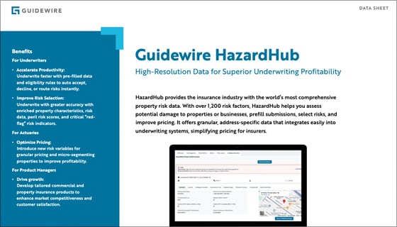
HazardHub (U.S.) Data Sheet
Data Sheet