
The Risk is Where You Live
The Risk is Where You Live
In the wake of natural catastrophes and extreme weather events, headlines often discuss whether these events correlate with global climate change. However, they often leave out a key culprit and, in doing so, miss an opportunity to educate the public and begin to build consensus for change.
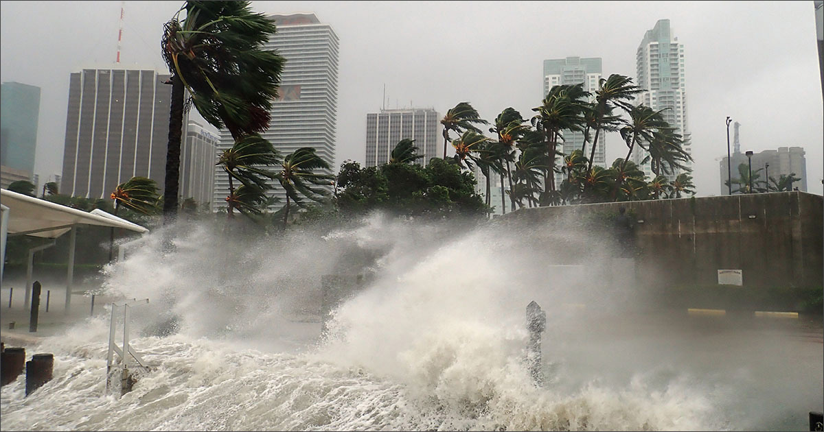
Whether it's hurricanes, floods, or wildfires, we're experiencing more impacts from these events in large part because we're increasingly living and building in areas prone to these natural catastrophes.
To illustrate this, consider that the population of Florida and Texas have both doubled since the 1980s. Florida's population has increased 18% since 2010. While the population of Texas has grown 19% in the same time.
And these same two states are the two states most often hit with hurricanes. Further, Texas is the riskiest state in terms of tornadoes, while Florida is among the riskiest (ranked second) in terms of flood risk. They both also are the riskiest in terms of total number of lightning strikes per square mile.
Natural catastrophe risks are increasing – and they are projected to continue to do so – yet people are increasingly moving to places highly prone to natural catastrophes. And this is not just limited to Florida or Texas.
States and Municipalities Need to Understand Risks
On a governmental level, states and localities need to consider an area's inherent risks more fully when making decisions about where to permit development, to what extent, and to what standards.
They also need to plan in ways that are more reflective of the risks their communities face – and seek to mitigate the extent and impacts of those risks. One such way is through building codes, which in many locations are inadequate to the perils common to the area. And while building codes are great for structure survivability, they're not a cloak of invincibility. Significant damage can still occur depending on where a structure is built.
Too often our public practices and policies are not reflective of these realities. A recent University of California, Berkeley think tank study found that California and "local land use policies, coupled with the state's housing shortage, are ratcheting up the economic and human cost of wildfire by incentivizing rebuilding in high risk [areas]."
HazardHub data shows that 98% of the property damage in California is concentrated in the 10% of the state rated by HazardHub as an F for wildfire risk. Homes and structures in these areas are 50 times more likely to suffer damage from wildfires. Regardless of the protective measures a municipality or individual property owner may take, if you build or live in an 'F' zone, you're significantly more prone to damage and losses from a wildfire.
Property Risk Awareness is Critical
On an individual level, the biggest challenge is awareness: getting people to understand and learn about their property risks – and then take action to mitigate those risks. Of course, it would be best to understand the risks before you decide where to move or buy a home. The best protection is to avoid altogether the highest-risk areas.
From an insurance industry perspective, there is much more we can do as well. The most significant action insurers can take is to harness the power of recent technology advances – and start assessing risk at a property level instead of the standard territorial-level ratings relying on zip-code and census block-level risk scores.
Perils Don't Respect Boundaries
Why? Well, for one, perils simply don't respect boundaries. When is the last time a fire, flood or hailstorm stopped at a municipal or ZIP code boundary?
And territorial boundaries are constantly changing, making maintaining related systems, data sets, and risk scores challenging. The standard territorial-based approach can't account for risks precisely enough to accurately determine future propensity for losses.
Geospatial technology and data advances have set the foundation for a new era of property risk data and analytics. One where up-to-date and property-specific data and risk scores are readily available in the underwriting, risk selection, and pricing processes. One where insurers can rate by peril at the exact address level rather than by ZIP code or census block.
Tags
Più Popolari